Public Comment by June 8, 2023 – Consolidated Port Approaches PARS
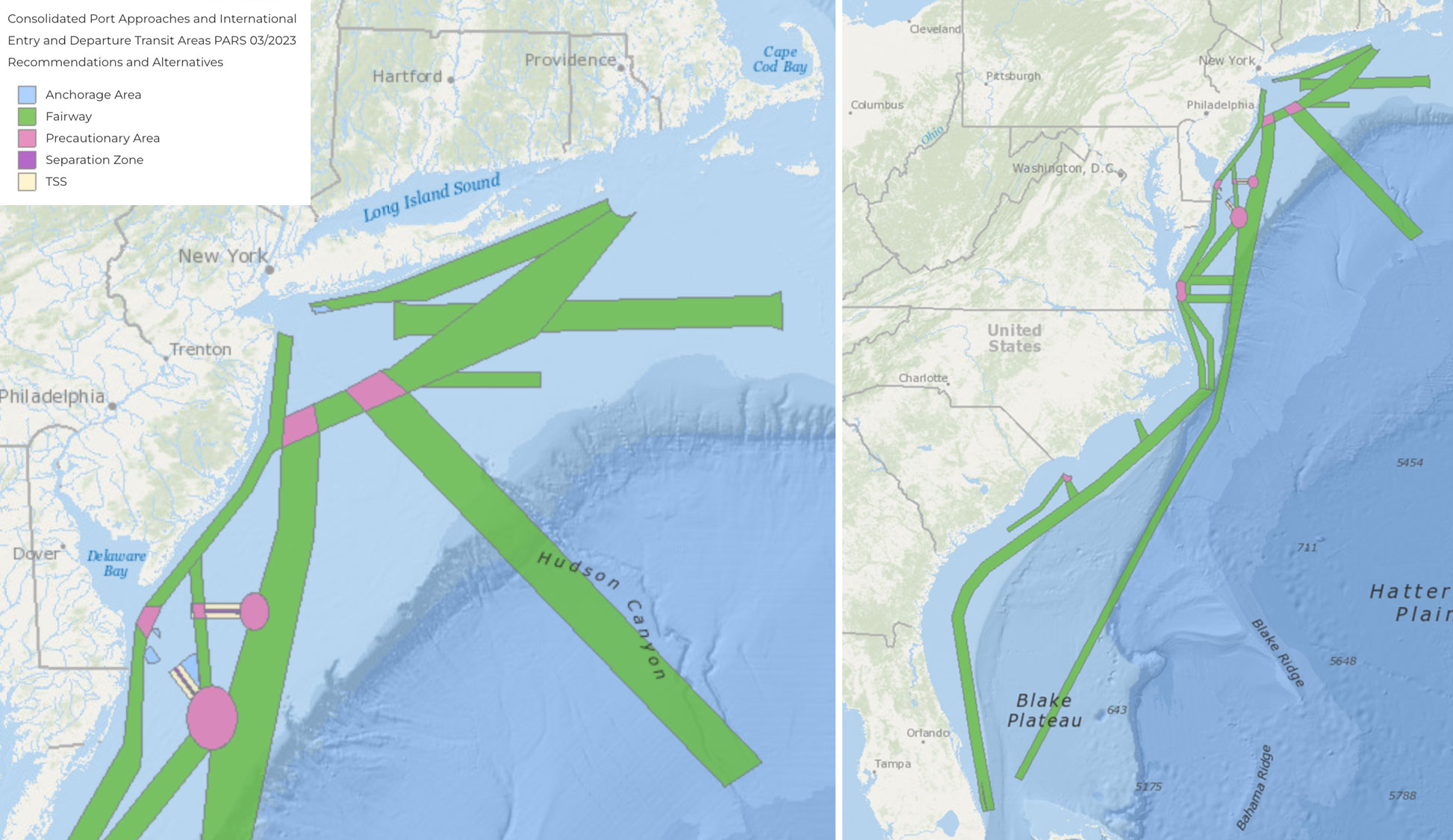
The Coast Guard announces the availability of an update to the Consolidated Port Approaches Port Access Route Studies (CPAPARS). The CPAPARS summarizes the findings of four regional port access route studies: the Northern New York Bight; Seacoast of New Jersey Including Offshore Approaches to the Delaware Bay, Delaware; Approaches to the Chesapeake Bay, Virginia; and the Seacoast of North Carolina; as well as ongoing dialogue with the maritime industry. View the study and the instructions for submitting comment by June 8, 2023, at regulations.gov. Questions about the report may also be emailed to maureen.r.kallgren2@uscg.mil.
The CPAPARS map layer can be found in the Data Explorer under Marine Transportation > Proposed Areas and Studies.
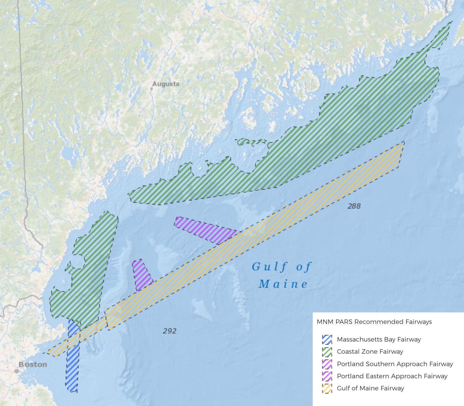
On April 6, the First Coast Guard District announced the completion of the Approaches to Maine, New Hampshire, and Massachusetts Port Access Route Study (MNMPARS). The MNMPARS final report is available for viewing and download at regulations.gov. This study was conducted to evaluate the adequacy of existing vessel routing measures and determine whether additional vessel routing measures are necessary for port approaches to Maine, New Hampshire, and Massachusetts and international and domestic transit areas in the First Coast Guard District area of responsibility. The MNMPARS considered whether routing measure revisions were necessary to improve navigation safety due to several factors such as planned or potential offshore development, current port capabilities and planned improvements, increased vessel traffic, changing vessel traffic patterns, weather, or navigational difficulty. View the notices and steps to develop the MNMPARS on the Coast Guard Proposed Actions page.
Portal users can view the recommendations contained in the report in the Data Explorer under Marine Transportation > Proposed Areas and Studies.


