


Map Galleries
Map Galleries
Current Issues Map Galleries provide quick access to ready-made, interactive maps relating to issues in the northeastern US region, with many of the maps featuring customized combinations of data. Archived Map Galleries relate to topics for which a planning or management process has been completed.
CURRENT ISSUES GALLERIES

Map Gallery
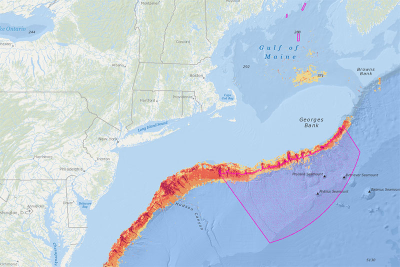
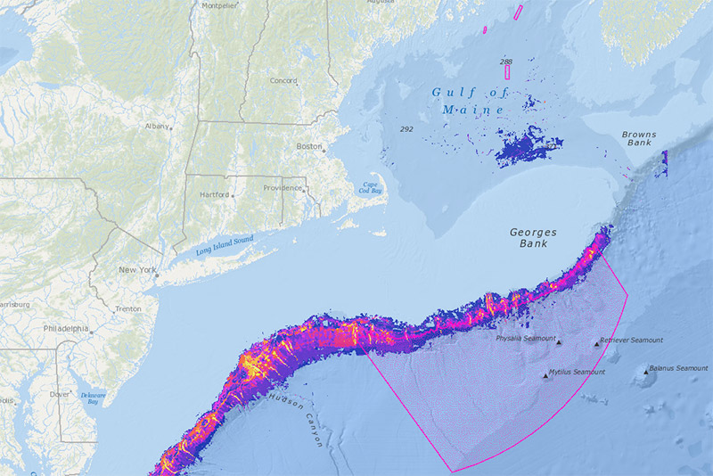
Northeast Canyons and Seamounts
Interactive versions of Figures 12-18 in the Northeast Canyons and Seamounts Marine National Monument Draft Management Plan and Environmental Assessment (2023). Public comment period ends October 26, 2023.
ARCHIVED GALLERIES
Map Gallery
Deep-Sea Corals
Maps relevant to the Omnibus Deep-Sea Coral Amendment implemented by the New England Fishery Management Council.
Map Gallery
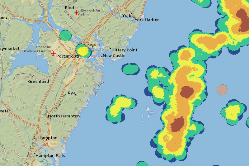
Isles of Shoals North Disposal Site
Maps showing the location of an ocean dredged materials disposal site established in September 2020 approximately 10.8 nautical miles east of Portsmouth, New Hampshire. Includes interactive versions of some of the maps from US EPA’s Environmental Assessment and Evaluation Study.
Map Gallery
Northeast Canyons and Seamounts
Interactive versions of Figures 12-18 in the Northeast Canyons and Seamounts Marine National Monument Draft Management Plan and Environmental Assessment (2023). Public comment period ends October 26, 2023.
ARCHIVED GALLERIES
Map Gallery
Deep-Sea Corals
Maps relevant to the Omnibus Deep-Sea Coral Amendment implemented by the New England Fishery Management Council.
Map Gallery
Isles of Shoals North Disposal Site
Maps showing the location of an ocean dredged materials disposal site established in September 2020 approximately 10.8 nautical miles east of Portsmouth, New Hampshire. Includes interactive versions of some of the maps from US EPA’s Environmental Assessment and Evaluation Study.