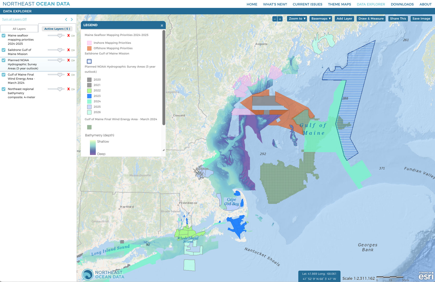
Several entities are conducting and planning to conduct seafloor mapping and characterization activities in the Gulf of Maine within the next year.
Several new and updated layers in the Data Explorer, within the Bathymetry & Imagery category, show the footprints of the proposed mapping areas, which overlap part of the Gulf of Maine Final Wind Energy Area:
- Saildrone Gulf of Maine Mission – NOAA Fisheries & Saildrone autonomous mapping in the eastern Gulf of Maine
- Planned NOAA Hydrographic Survey Areas (3-year outlook) – NOAA ship Hassler planned mapping area (light green)
- Maine seafloor mapping priorities – Department of Marine Resources and Governor’s Energy Office through the Maine Coastal Mapping Initiative and with funding from the Maine Offshore Wind Research Consortium


