Mar 27, 2025
The Northeast Ocean Data Portal has updated and reorganized the data depicting federally designated critical habitats for marine endangered species. Critical habitat data layers for species in the Atlantic Ocean are now included in each relevant taxonomic category in the Data Explorer.
When a species is listed under the Endangered Species Act (ESA), the responsible federal agencies evaluate and identify whether any areas meet the definition of critical habitat. Critical habitat is defined as specific areas within the geographical area occupied by the species at the time of listing that contain physical or biological features essential to conservation of the species and that may require special management considerations or protection; and specific areas outside the geographical area occupied by the species if the agency determines that the area itself is essential for conservation.
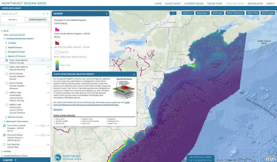
States may have their own laws designating and protecting endangered species. State-listed species can be different from federally listed species (more below).
Marine Mammals
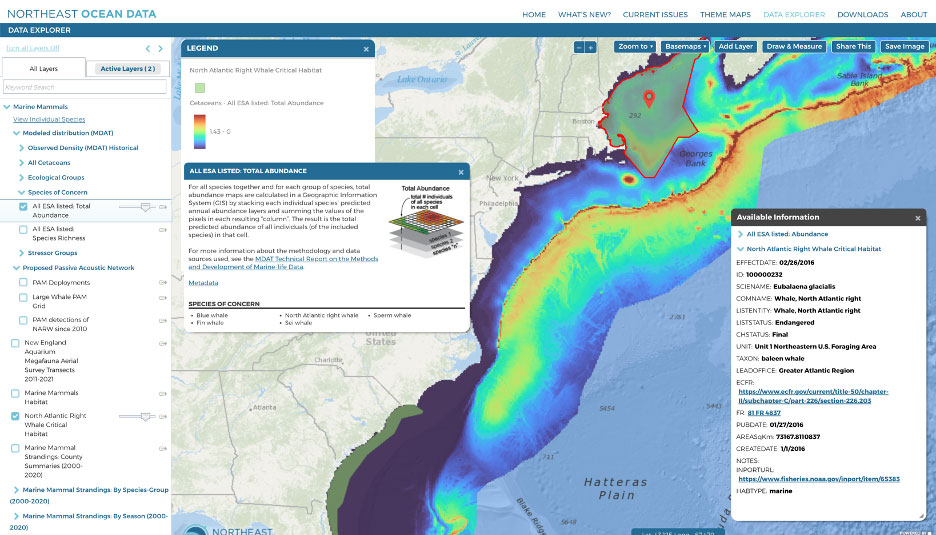
A layer showing the designated North Atlantic right whale critical habitat is available under the Marine Mammals topic in the Data Explorer. Four other whale species that occur in our region are listed under the ESA but do not have critical habitat defined in our region. These species include blue whale, fin whale, sperm whale, and sei whale. Their distribution, along with that of North Atlantic right whale, can be mapped by selecting All ESA Listed: Total Abundance under Marine Mammals > Marine Mammal Summary Products > Species of Concern.
Data Provider(s):
- U.S. Fish & Wildlife Service (USFWS)
- NOAA
- Marine-life Data and Analysis Team (MDAT)
Sea Turtles
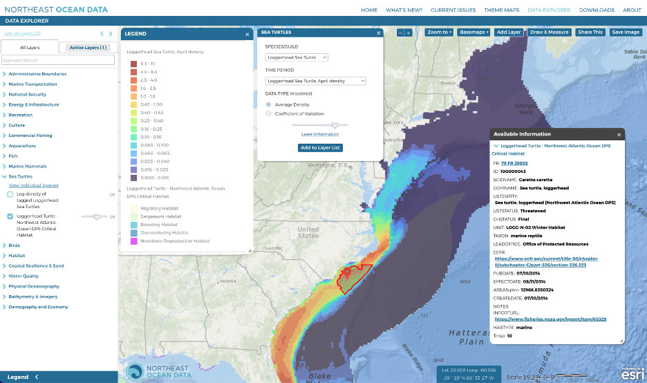
A layer showing critical habitat for the Northwest Atlantic Distinct Population Segment (DPS) for loggerhead turtle is available under the Sea Turtles topic in the Data Explorer. Portal users can also overlay monthly predicted densities of loggerhead turtles by selecting Sea Turtle Density by Species under the Sea Turtles topic. Five other sea turtle species found in U.S. water are all listed and protected under the ESA – green, hawksbill, Kemp’s ridley, leatherback, and olive ridley – but do not have critical habitat defined in our region. The Portal contains predicted density maps for four species (green, Kemp’s ridley, leatherback, loggerhead).
Birds
Four species of seabirds and shorebirds in our region are ESA-listed: rufa red knot, piping plover, roseate tern, and black-capped petrel. Two layers from the U.S. Fish & Wildlife Service show proposed and final critical habitat in the Atlantic for rufa red knot (endangered) and piping plover (threatened). Roseate tern and black-capped petrel do not have critical habitat defined in our region. The available critical habitat layers can be found under Birds > Bird Habitat in the Data Explorer. Whereas the Portal currently does not contain relative density models for rufa red knot or piping plover, models for roseate tern and black-capped petrel are available under Birds > Bird Summary Products > Bird Relative Density by Species.
Because there are a few more bird species listed as endangered by individual New England and Mid-Atlantic states than are federally listed, the Marine-life Data and Analysis Team (MDAT) developed a species group called State-Listed Species. Portal users can view State-Listed Species: Relative Density and State-Listed Species: Species Richness by selecting them under Birds > Bird Summary Products > Species of Concern in the Data Explorer.