


The proposed site would serve the long-term need for possible future disposal of suitable dredged material from harbors and navigation channels.
Public comment period announcement
On September 18, 2019, the US Environmental Protection Agency (EPA) announced a proposal to designate a new ocean dredged materials disposal site, the Isles of Shoals North (IOSN) Disposal Site, located approximately 10.8 nautical miles east of Portsmouth, New Hampshire. The proposed action is described in a Draft Environmental Assessment and Evaluation Study (EA) conducted by EPA in cooperation with the US Army Corps of Engineers (USACE). The EA contains a draft finding of No Significant Impact and a Site Management and Monitoring Plan. There is a 30-day public comment period ending October 18, 2019.
The proposed Isles of Shoals North dredged materials disposal site boundaries can now be viewed on the Northeast Ocean Data Portal. The proposed disposal site can be overlaid with any other map layers in the Data Explorer, including fisheries, marine life, and vessel traffic, for example.
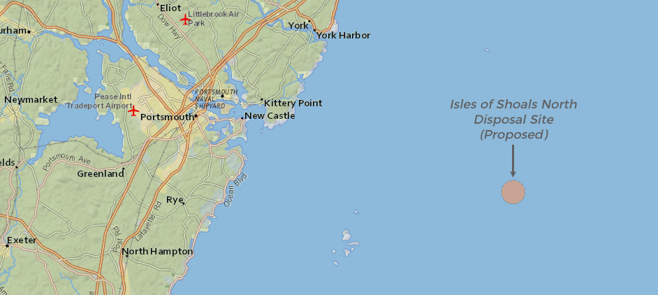
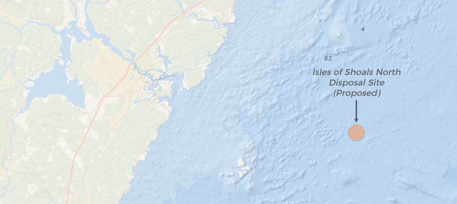
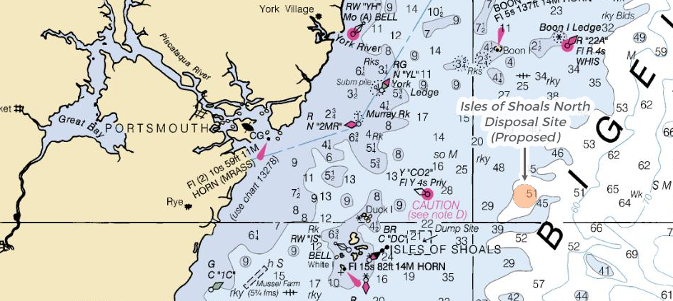
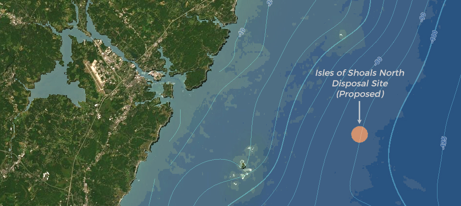
Proposed location of the Isles of Shoals North Disposal Site. Click the tabs to view the location on different basemaps, nautical chart, or satellite imagery.
Under the Marine Protection, Research and Sanctuaries Act (MPRSA), EPA Region 1 (which includes Connecticut, Rhode Island, Massachusetts, New Hampshire, Vermont, Maine, and 10 tribal nations) and the USACE New England District share responsibility for regulation of dredged material disposal in ocean waters as well as Long Island Sound. Dredging occurs when navigational channels, harbors, or other areas need to be deepened or maintained so that vessels can safely maneuver.
View the EPA’s Isles of Shoals North Disposal Site page and read the Draft Environmental Assessment and Evaluation Study for Designation of an Ocean Dredged Material Disposal Site for the Southern Maine, New Hampshire, and Northern Massachusetts Coastal Region (IOSN EA).
View the Proposed Rule in the Federal Register, including instructions on how and where to submit comments by October 18, 2019.
Visit EPA Region 1’s Ocean Dumping page for more information about the management and regulatory process.
Maps, data, and other information
The Northeast Ocean Data Portal contains several layers relevant to the proposed Isles of Shoals North (IOSN) Disposal Site. A new layer showing the boundaries of the site has been recently added and can be viewed along with existing Active Ocean Disposal Sites and Inactive Ocean Disposal Sites.
In the Data Explorer, users can overlay the proposed IOSN disposal site with any other resource or activity. To find the proposed IOSN Disposal Site, in the Table of Contents, select “Marine Transportation”, and then “Navigation”.
The Draft IOSN Environmental Assessment and Evaluation Study contains maps depicting several datasets from the Northeast Ocean Data Portal. Interactive versions of some of the Draft EA maps are provided below.
View an interactive map of surficial sediment types near the proposed IOSN Disposal Site (Figure 6-1 in the Draft EA):

View an interactive map of herring fishery activity for 2015-2016 near the proposed IOSN Disposal Site (Figure 6-9 in the Draft EA):

View an interactive map of shipwrecks in the vicinity of the proposed IOSN Disposal Site (Figure 6-10 in the Draft EA):

View an interactive map of annual vessel transit counts in 2017 near the proposed IOSN Disposal Site (Figure 6-11 in the Draft EA):

