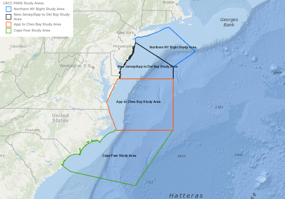
The boundaries for five U.S. Coast Guard-led Port Access Route Study (PARS) areas along the East Coast are now presented in the Portal. New layers include the study area for The Areas Offshore Massachusetts and Rhode Island PARS, which was recently completed on May 27, 2020. In addition, the new layers include the boundary for a new Northern New York Bight PARS that is currently subject to public comment.
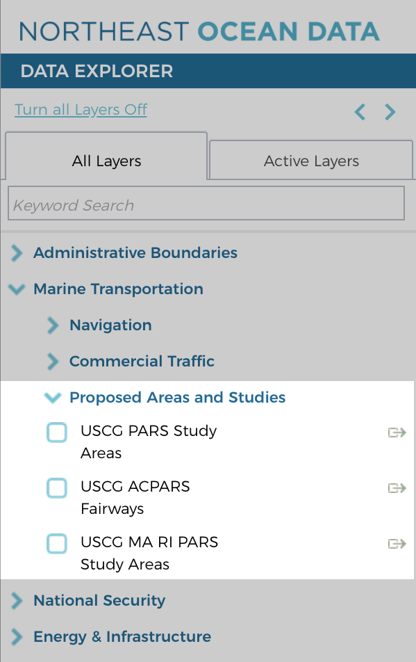
The new layers can be found in the Data Explorer in a new category called Proposed Areas and Studies under Marine Transportation, or enter ‘PARS’ in the Data Explorer’s keyword search bar.
Northern New York Bight PARS
The Coast Guard is conducting the Northern New York Bight PARS to evaluate the adequacy of existing vessel routing measures and determine whether additional ones are necessary for the approaches to the Port of New York and New Jersey and international and domestic transit areas in the vicinity. The PARS will consider factors such as planned or potential offshore development, current port capabilities and anticipated improvements, increased vessel traffic, existing and potential anchorage areas, changing vessel traffic patterns, effects of weather and navigational difficulty.
Vessel routing measures, which include traffic separation schemes, two-way routes, recommended tracks, deep-water routes, precautionary areas and areas to be avoided, are implemented to reduce the risk of marine casualties. The recommendations of the study may subsequently be implemented through rulemakings or in accordance with international agreements.
The First Coast Guard District, Coast Guard Sector New York, and Coast Guard Sector Long Island Sound are conducting this PARS. The area extends approximately 150 nautical miles seaward and covers approximately 25,000 square nautical miles, including the offshore area of New Jersey and New York used by private, commercial, and public vessels transiting to and from these ports. The study may take a year or more to complete.
Two virtual public meetings will be held via webinar and teleconference to provide an opportunity for oral comments on Thursday, July 30, 2020, beginning at 9 a.m. EST, and on Tuesday, August 11, 2020, beginning at 6 p.m. EST. All public comments and related material must be submitted to the Coast Guard by August 28, 2020. For more information on the PARS, the virtual public meetings, and instructions for submitting comments, view the study notice in the Federal Register.
Screenshot of USCG PARS Study Areas
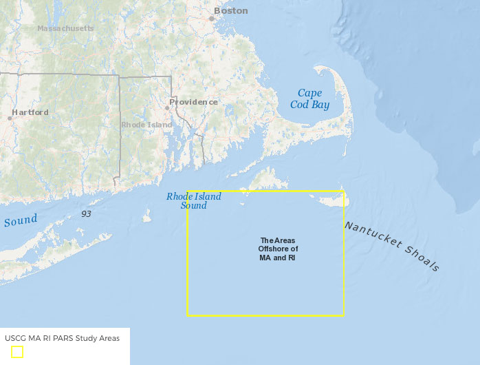
The Areas Offshore MA and RI PARS
The MARI PARS focused on the seven adjacent leased areas of the outer continental shelf south of Martha’s Vineyard, Massachusetts, and east of Rhode Island that together constitute the Massachusetts/Rhode Island Wind Energy Area (MA/RI WEA). The study was conducted to (1) determine what, if any, navigational safety concerns exist with vessel transits in the study area; (2) determine whether to recommend changes to enhance navigational safety by examining existing shipping routes and waterway uses as any or all of the lease areas within the MA/RI WEA are partially or fully developed as wind farms; and (3) to evaluate the need for establishing vessel routing measures.
The study resulted in the following general recommendations:
- That the MA/RI WEA’s turbine layout be developed along a standard and uniform grid pattern with at least three lines of orientation and standard spacing to accommodate vessel transits, traditional fishing operations, and search and rescue operations, throughout the MA/RI WEA. The adoption of a standard and uniform grid pattern through BOEM’s approval process will likely eliminate the need for the USCG to pursue formal or informal routing measures within the MA/RI WEA at this time.
- That mariners transiting in or near the MA/RI WEA should use extra caution, ensure proper watch and assess all risk factors. Offshore renewable energy installations present new challenges to safe navigation, but proper voyage planning and access to relevant safety information should ensure that safety is not compromised. In general, mariners transiting through this WEA should make a careful assessment of all factors associated with their voyage.
For a more detailed discussion of the recommendations, which were primarily based on the comments received to the docket, public outreach, and consultation with other government agencies, view the Federal Register Notice.
Screenshot of USCG MA RI PARS Study Areas map layer


