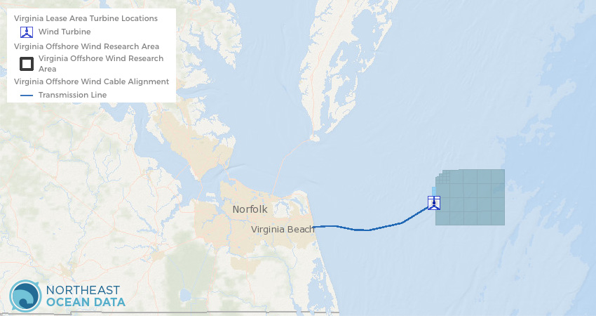
In partnership with the Mid-Atlantic Ocean Data Portal, the locations of the first offshore wind turbines in U.S. federal waters off the coast of Virginia are now available to view on the Northeast Ocean Data Portal.
The new Virginia Offshore Wind Turbine Locations map layer, along with the previously published Virginia Offshore Wind Turbine Area and Virginia Offshore Wind Cable Alignment layers, are viewable in the Energy and Infrastructure theme maps and in the Data Explorer.
Installation was completed on the two turbines in the summer of 2020 and they became fully operational in October. The Portal’s Offshore Wind Projects page has also been updated to reflect this change in project status.
The Coastal Virginia Offshore Wind (CVOW) pilot project is designed to demonstrate a grid-connected, 12-megawatt offshore wind test facility on the Outer Continental Shelf about 27 miles off the coast of Virginia Beach. The data obtained and lessons learned from this project will be made publicly available and inform the future production of renewable energy within the adjacent commercial lease area, where construction is expected to begin in 2024. The research site is leased by the Commonwealth of Virginia’s Department of Mines, Minerals and Energy. Dominion Energy was designated as the lease operator and contracted with Ørsted to construct the turbines and L.E. Myers Company to perform onshore electrical design and construction.
For more information, visit the Bureau of Ocean Energy Management’s CVOW project page and Dominion Energy’s Coastal Virginia Offshore Wind page.