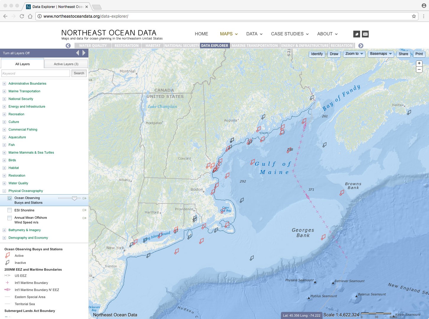
The Data Explorer screenshot below shows the updated ocean observing buoys and stations layer. Click on the map to see a larger screenshot. Click on the blue button to open an interactive version of this map in the Data Explorer.
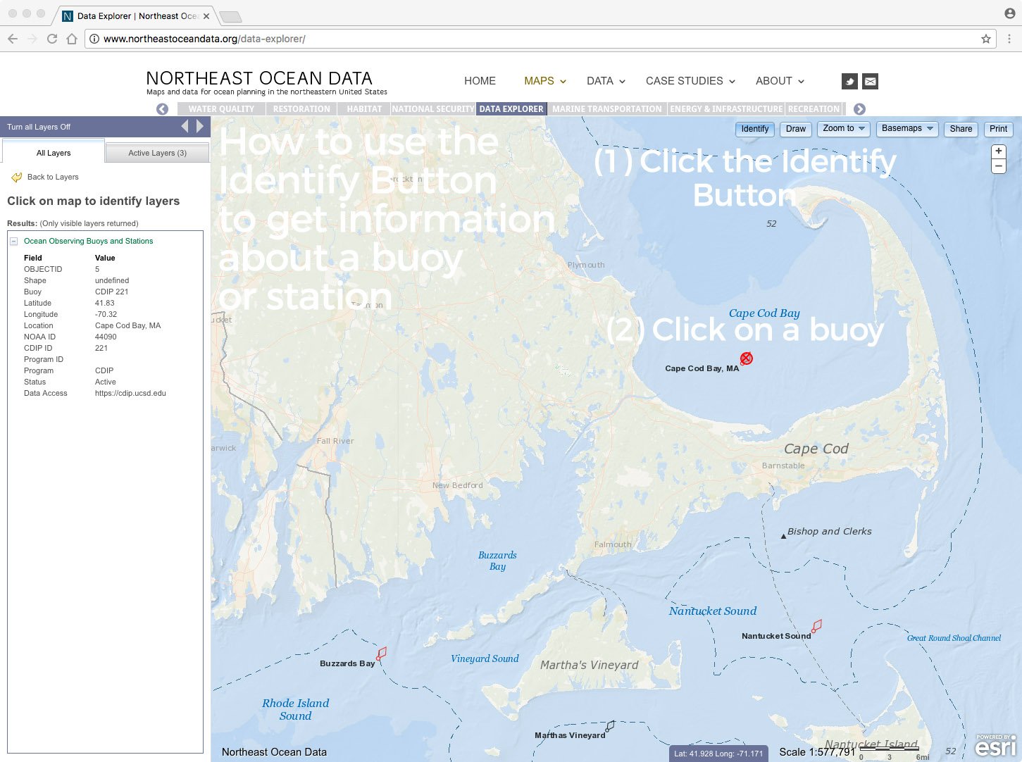
To get information about a particular buoy or station, click on the Identify button in the upper right area of the map. Then click on the buoy symbol on the map. The information will appear in the box on the left side of the map.
To access the map directly in the Data Explorer, click on Physical Oceanography in the table of contents on the left side and then select Ocean Observing Buoys and Stations.


