Dec 10, 2025
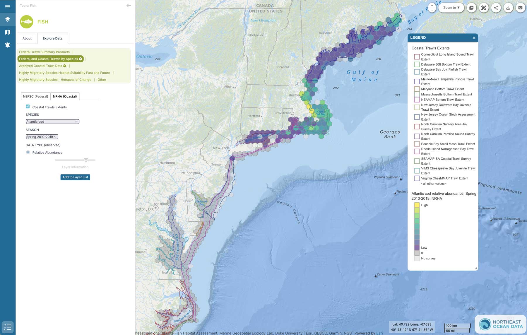
The Northeast and Mid-Atlantic Ocean Data Portals, in coordination with the Northeast Regional Habitat Assessment (NRHA) and the Marine-life Data and Analysis Team (MDAT), have released new maps that illustrate the relative abundance of several coastal fish species in the northeastern U.S. as reflected in repeated coastal trawl surveys.
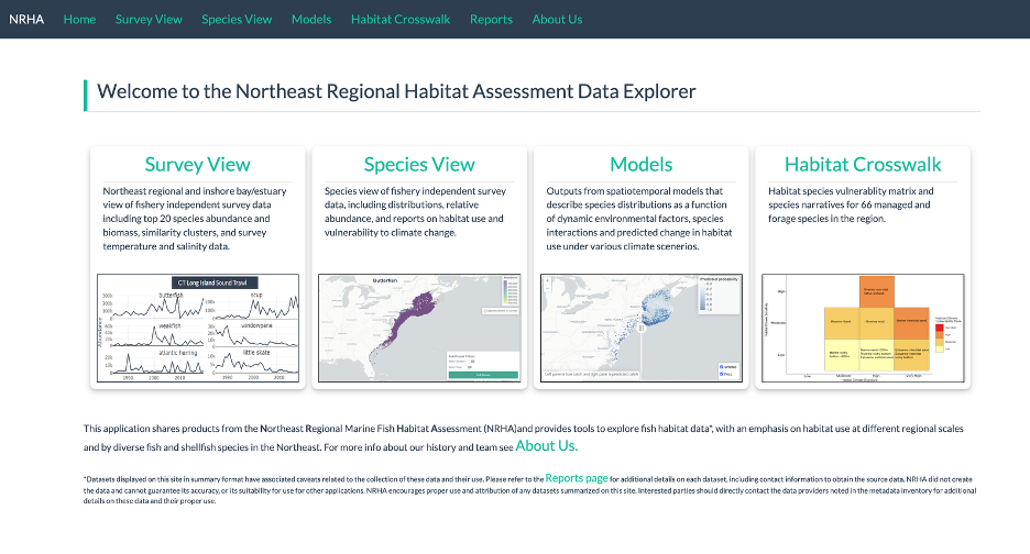
The NRHA is a collaborative, multi-disciplinary effort to describe and characterize estuarine, coastal, and offshore fish habitat distribution, abundance, and quality in the region. NRHA is led by the Mid-Atlantic and New England Fishery Management Councils with a dedicated Steering Committee. The NRHA team assembled and collated data from the federal trawl survey (operated by NOAA Fisheries) and the many state and coastal trawl and other fishery-independent surveys operated along the Atlantic coast over the past 60 years. These data and other data products are viewable in the Northeast Regional Habitat Assessment Data Explorer.
The Northeast Ocean Data Portal and MDAT collaborated with the NRHA team to integrate a subset of NRHA data products into the regional ocean data portals for users to access. The new data products derived from NRHA compile data from 16 coastal trawl surveys to summarize the relative abundance of 14 northeast/mid-Atlantic coastal fish species for spring and fall from 2010-2019 from Maine to Florida:
American lobster
Atlantic cod
Bay anchovy
Black sea bass
Bluefish
Haddock
Little skate
Longfin squid
Scup
Silver hake
Striped bass
Summer flounder
Winter flounder
Yellowtail flounder
Data Provider(s):
- Northeast Regional Habitat Assessment (NRHA)
- Marine-life Data and Analysis Team (MDAT)
The NRHA Maps and Methods Report includes more detail on the methods used to compile this dataset, the trawl source data, the trawl methods, and the additional species, years, and federal trawl datasets that NRHA also leverages in the dedicated NRHA Data Explorer. The NRHA Data Explorer includes additional data visualizations and information beyond what is shown in the portals, with a key focus on species distribution maps that display mean abundance estimates across hexagonal grid cells. One of their interactive visualizations allows users to filter by species, trawl surveys (one or multiple), and year/year range, enabling a custom view of species abundance.
To access these new data layers, Northeast Ocean Data Portal users can navigate to “Fish” under the Table of Contents, then select “Federal and Coastal Trawls by Species”. Select the NRHA tab, then the species and season of interest. An outline showing the extent of each trawl survey will also appear on the map with these layers, but note that the inclusion of each trawl in determining species relative abundance depends on the species and season. For more information, click on any hexbin of interest and the trawls included in the value for that hexbin will be provided under “Trawl_Sources.”
To access these new data layers, Mid-Atlantic Ocean Data Portal users can navigate to “Marine Life Library (Species Specific)” under the Table of Contents, then select “Fish BioMass NRHA Abundance” and select the species and season of interest to add to the map. There is also a layer “Coastal Trawl Extents” that will show the extent of the coastal trawls included in the NRHA data. Please note that not all trawls are included in every species or season, so to understand which trawls were used to calculate the relative abundance of any given hexbin, click on that hexbin and the field “Trawl_Sources” will identify the trawls used for that cell.
MDAT first developed coastal fish data products in 2016, reflecting the Maine/New Hampshire trawl, the Massachusetts Division of Marine Fisheries trawl, the North East Area Monitoring and Assessment Program (NEAMAP) trawl, and the Connecticut DEEP Long Island Sound trawl. These data products are now considered archived but are still available in the table of contents under Fish > “View Archived Coastal Trawl Data”.
Learn More on Webinar
Join us for a special “How Tuesday” webinar hosted by the Mid-Atlantic Data Portal team and focused on these data and the NRHA effort they were derived from on Jan. 27 at 11 a.m.
In this session, Duke University Marine Geospatial Ecology Lab (MGEL) Geospatial Analyst Sarah DeLand will provide an overview of the data, how it was compiled, and how to access them on the Mid-Atlantic and Northeast Ocean Data Portals. Mid-Atlantic Fishery Management Council Fishery Management Specialist Tori Kentner will share further background on NRHA and demonstrate how to access many additional marine life map products via the NRHA Data Explorer.
The webinar is open to the public and will include a Q&A with the presenters. Click here to register. A Zoom link will be provided upon registration.